
Marine Electromagnetic Navigation Accuracy: What Affects Position Stability at Sea?
Why does marine electromagnetic navigation accuracy matter so much offshore?
Marine electromagnetic navigation accuracy is not just a technical score. It determines whether a vessel holds a stable track, trusts chart data, and reacts safely in changing water conditions.
At sea, position stability depends on a chain of systems. Satellite signals, onboard receivers, antennas, processing logic, and surrounding electromagnetic noise all shape the final result.
That is why marine electromagnetic navigation accuracy cannot be judged by signal bars alone. A strong signal may still produce drift, jumps, or delayed correction.
In practical marine operations, the bigger question is simple: how consistently can a navigation system maintain a believable position when the environment becomes unstable?
This is also why intelligence platforms such as GNCS pay close attention to precision spatial perception. In both navigation and safety engineering, accuracy is never one component deep. It is built through system-level coordination.
When people ask about position drift, what are they really asking?
Usually, they are asking why the vessel icon seems to wander, lag, or shift even when the route looks simple. That visible drift often comes from several smaller errors combining at once.
One source is the electromagnetic environment itself. Reflected signals from superstructures, cranes, masts, and nearby vessels can distort reception and reduce marine electromagnetic navigation accuracy.
Another source is motion. Pitch, roll, yaw, and heave affect antenna geometry and timing. In calm water the effect may be limited. In rough seas it becomes harder to ignore.
Then there is atmosphere. Ionospheric delay, solar activity, and regional weather patterns can change signal travel conditions. These effects are not always dramatic, but they do influence position stability.
More often, the issue is not one dramatic failure. It is a layered accuracy loss across sensors, installation, updates, and processing settings.
A quick way to separate symptoms from causes
The table below helps connect common observations with likely reasons behind marine electromagnetic navigation accuracy problems.
This kind of structured diagnosis matters because marine electromagnetic navigation accuracy is often reduced by interactions, not isolated faults.
Which factors usually have the biggest impact on position stability at sea?
In real deployments, four factors usually dominate. They are the signal environment, installation quality, sensor fusion design, and maintenance discipline.
- Signal environment: interference from onboard electronics, radars, converters, and communication equipment can lower usable signal quality.
- Installation quality: a well-specified antenna still underperforms if mounted too close to reflective surfaces or vibration-heavy zones.
- Sensor fusion design: combining GNSS, inertial sensors, gyro data, sonar, and AIS improves resilience only when data timing is aligned.
- Maintenance discipline: firmware updates, calibration checks, and correction service validation keep marine electromagnetic navigation accuracy from slowly degrading.
The strongest setups do not rely on one positioning source. They build redundancy. If one stream weakens, another helps preserve believable navigation output.
That system thinking mirrors broader mobility engineering. GNCS often tracks how safety and perception performance depend on integration quality, whether the subject is navigation electronics or cabin protection systems.
Is better hardware enough, or does setup matter just as much?
Setup matters just as much, and sometimes more. A premium receiver cannot fully recover from poor antenna location, grounding issues, or inconsistent sensor timing.
A common mistake is to compare equipment only by brochure accuracy. Offshore performance depends on how the full navigation chain behaves under motion, noise, salt exposure, and partial signal blockage.
Another mistake is treating calibration as a one-time event. Marine electromagnetic navigation accuracy changes over time as equipment ages, vessel layouts evolve, and onboard electronics increase.
In practical terms, a stable configuration should answer three questions clearly:
- Is the antenna positioned for clean sky visibility and low reflection risk?
- Are motion sensors, gyro inputs, and correction feeds synchronized correctly?
- Is there a routine for software, diagnostics, and performance review?
If those answers are weak, headline equipment specifications become less meaningful.
How should marine electromagnetic navigation accuracy be judged in different use cases?
Not every vessel needs the same tolerance. Open-ocean routing, coastal passage, offshore support work, dredging, survey tasks, and dynamic positioning all judge accuracy differently.
For long-range transit, continuity and reliability may matter more than centimeter-level precision. For offshore construction or survey activity, small errors can quickly become operationally expensive.
A useful comparison is below.
So when evaluating marine electromagnetic navigation accuracy, the better question is not “How accurate is it?” but “Accurate enough for which operational consequence?”
What mistakes make accuracy look better on paper than at sea?
One frequent mistake is trusting laboratory figures without matching them to offshore conditions. Bench performance says little about vibration, corrosion, or mixed-frequency interference onboard.
Another is focusing on average accuracy while ignoring stability over time. A system may post good snapshots but still suffer intermittent jumps that disrupt navigation decisions.
There is also a data interpretation problem. Some users read corrected position output as final truth, even when correction streams are delayed or quality flags suggest uncertainty.
More careful evaluation usually includes:
- Time-based stability, not just point accuracy
- Error behavior during weather and motion changes
- Sensitivity to nearby emitters and structural reflections
- Recovery speed after signal interruption
This is where industry intelligence becomes useful. Tracking compliance trends, update protocols, and equipment evolution helps separate market claims from dependable marine electromagnetic navigation accuracy in service.
If someone is researching the topic, what should they check next?
Start by defining the operating scene. Offshore transit, harbor approach, survey work, and safety-critical support operations do not stress navigation systems in the same way.
Then review the accuracy chain, not just the receiver. Check antenna location, correction source type, sensor fusion logic, maintenance intervals, and environmental exposure history.
It also helps to compare stability metrics over time. Repeated position consistency often reveals more than a single best-case specification.
Marine electromagnetic navigation accuracy is gained through disciplined integration. It is lost when interference, motion effects, poor installation, and weak diagnostics are treated as separate issues.
A practical next step is to build a simple review checklist around operational scenario, acceptable drift, correction dependency, and onboard electromagnetic risk. That creates a clearer basis for comparing systems, update needs, and long-term reliability.
For ongoing research, follow sources that connect marine navigation performance with broader safety and compliance developments. That wider lens often explains where accuracy improvements will come from next.
Related News

How to Evaluate a Seat Sensing Technology Supplier for Safety and Integration?
Seat sensing technology supplier evaluation guide: compare safety maturity, integration fit, algorithm reliability, and validation support to choose a partner that reduces risk.

How to Evaluate Custom Smart Automotive Seating for Premium Vehicle Programs?
Custom smart automotive seating evaluation starts with safety, comfort, integration, and production readiness. Discover how premium vehicle teams choose smarter, lower-risk seat solutions.
B2B Product Intelligence Platforms: How to Compare Features, Data Coverage, and ROI
B2B product intelligence platform comparison: learn how to evaluate data coverage, feature depth, compliance visibility, and ROI to choose a sourcing tool that reduces risk and speeds decisions.

Climate Control Seats Cost: What Drives Price and Long-Term Ownership Value?
Climate control seats cost depends on materials, thermal tech, and integration. Learn what drives price and how to judge long-term value before you buy.
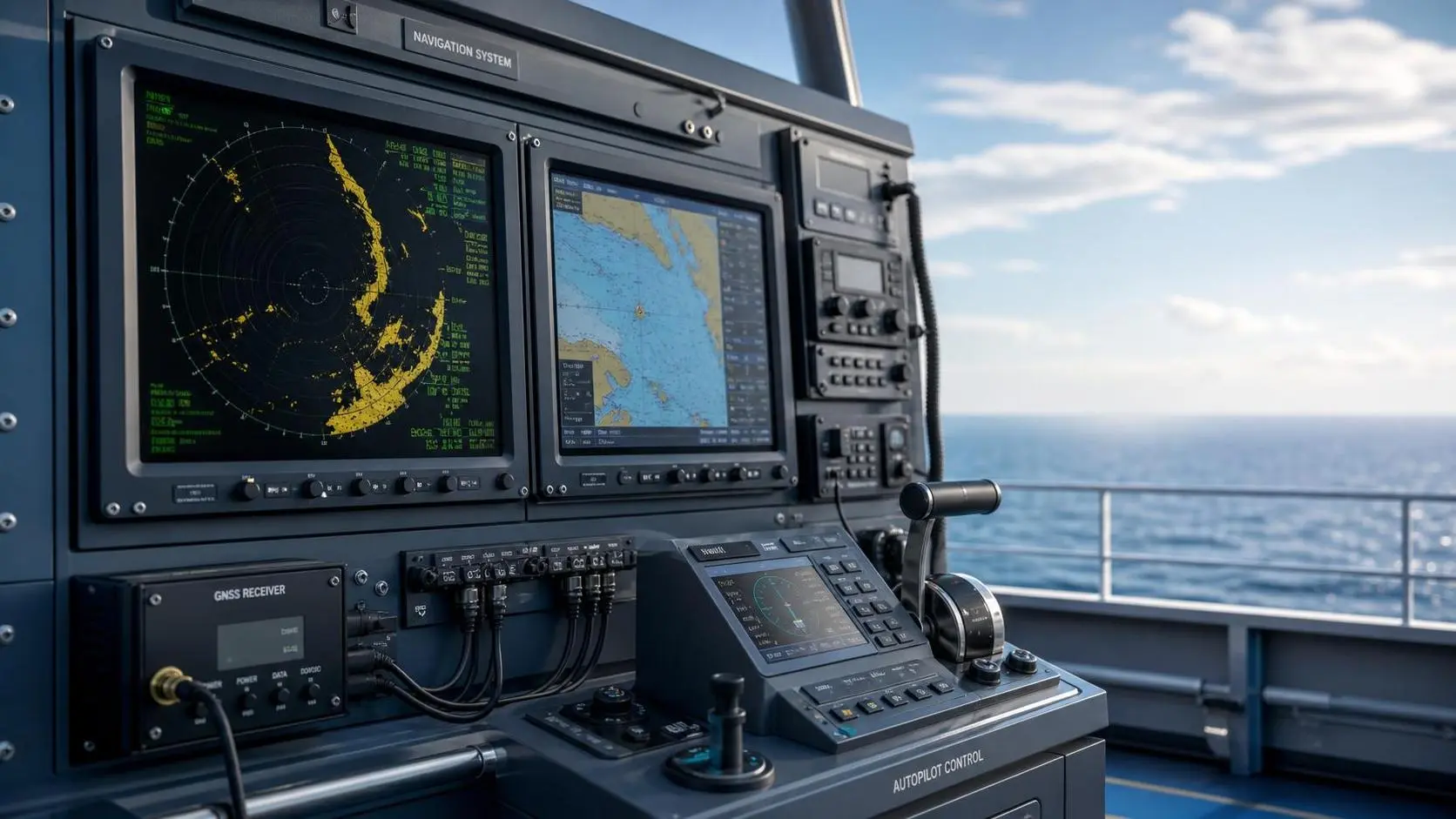
What Factors Drive Marine Navigation Components Cost in Commercial Vessel Projects?
Marine navigation components cost is shaped by integration, compliance, installation, and lifecycle support. Discover what drives pricing and how buyers can reduce risk while improving value.

How Much Does Seat Occupancy Sensing Cost? Key Pricing Factors for Buyers
Seat occupancy sensing price varies widely by technology, integration, and compliance needs. Learn the key cost drivers, avoid hidden fees, and make smarter buying decisions.

How to Specify Micro-Climate Control Cabins for Harsh Outdoor Worksites?
Micro-climate control cabins for harsh outdoor worksites: learn how to specify thermal control, filtration, pressurization, and durability for safer uptime and smarter buying.
How to Evaluate a B2B Product Knowledge Platform for Faster Procurement Decisions
B2B product knowledge platform procurement starts with reducing decision risk. Learn how to compare specs, compliance, and supplier data to speed sourcing with confidence.

How to Evaluate an Occupant Restraint Systems Exporter for Quality, Compliance, and Supply Risk
Occupant restraint systems exporter evaluation guide: learn how to verify quality controls, compliance evidence, and supply risk before sourcing to avoid recalls, delays, and hidden costs.
Related News
- 00
0000-00
How to Choose a Marine Positioning Solutions Supplier in Europe for Offshore and Port Operations - 00
0000-00
Marine Positioning Solutions Provider Comparison: GNSS, Accuracy, and Integration Factors - 00
0000-00
Marine Electromagnetic Navigation Accuracy vs GNSS: Which Performs Better Near Interference? - 00
0000-00
Marine Electromagnetic Navigation Accuracy: What Affects Position Stability at Sea? - 00
0000-00
Marine Positioning Systems Exporter Selection: What to Check in GNSS Accuracy, Compliance, and Support
Weekly Insights
Stay ahead with our curated technology reports delivered every Monday.