Which Marine Navigation System Is Best for Ocean-Going Vessels?
No single screen or instrument is the best marine navigation system for an ocean-going vessel. The best choice is an integrated, redundant bridge navigation system: one that combines satellite positioning, electronic charts, radar, vessel tracking, depth awareness, alarms, and independent backup methods.
For blue-water passages, a highly accurate GNSS receiver alone is not enough. Position data can be interrupted, chart data can be outdated, radar targets can be misinterpreted, and a single display failure can leave a watchkeeper without essential context. A suitable ocean-going system lets the bridge team cross-check information rather than trust one source blindly.
What an Ocean-Going Navigation System Should Include
The equipment mix depends on vessel type, trading area, bridge layout, and applicable carriage requirements. Still, most capable offshore navigation arrangements are built around the same core functions.
The practical answer to “Which marine navigation system is best for ocean-going vessels?” is therefore not a brand name. It is a properly integrated system in which these inputs are compatible, clearly presented, maintained, and supported by workable backup arrangements.
ECDIS Is Central, but It Is Not the Whole Navigation System
For vessels operating long international routes, ECDIS is usually the center of the electronic navigation workflow. It helps officers plan routes, apply safety settings, review charted dangers, monitor deviation from the intended track, and manage chart information in one place.
Its value depends heavily on how it is configured. Safety contour settings, cross-track limits, route checks, chart updates, and alarm management must reflect the vessel’s draft, maneuvering characteristics, operating area, and company procedures. An ECDIS display may look complete while still providing weak protection if the route was poorly checked or critical alarms are routinely acknowledged without investigation.
When selecting ECDIS capability, prioritize these operational questions:
- Can the system use approved electronic chart data and keep updates controlled across the fleet?
- Is the route planning workflow clear enough for officers to review, amend, and hand over safely?
- Can the display receive reliable radar overlay, heading, GNSS, AIS, and depth-related inputs where required?
- Are backup arrangements independent enough to remain useful after a display, network, or power-related failure?
- Can the crew access familiar controls and meaningful alarm information under pressure?
A feature-rich unit is not automatically the better choice. Complex interfaces can slow down routine watchkeeping if officers struggle to find the needed information. For an ocean-going vessel, consistency across primary and backup stations often matters more than adding rarely used functions.
Why Radar Still Decides Many Real-World Situations
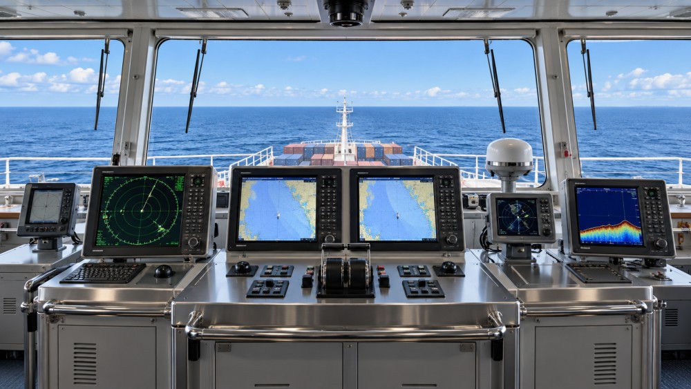
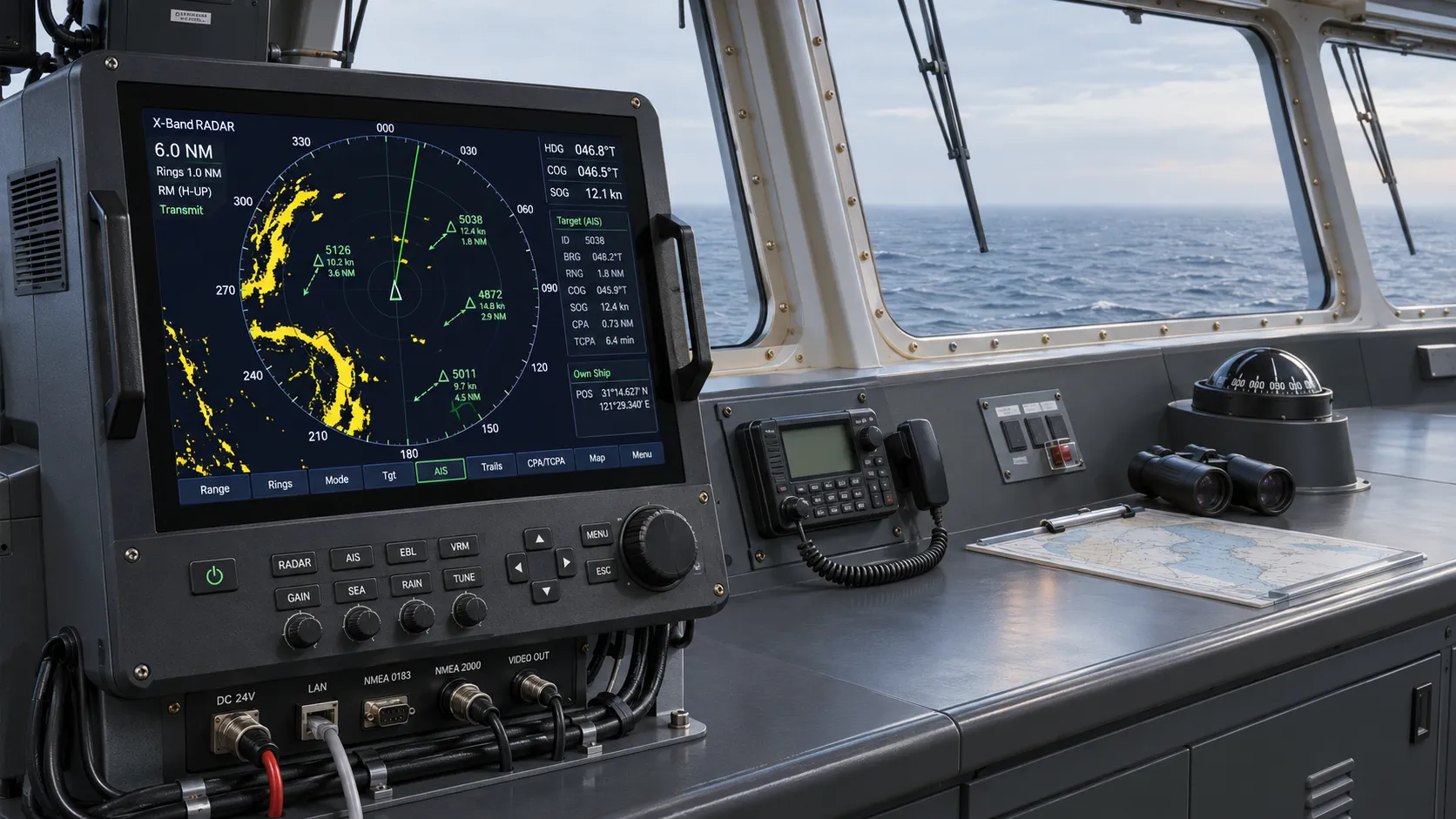
Satellite navigation tells the bridge where the vessel believes it is. Radar shows what is physically around it. That distinction becomes critical near coasts, in heavy rain, during fog, around fishing activity, or when another vessel’s AIS information is absent, delayed, incorrectly entered, or simply not transmitted.
A good marine radar installation should provide useful target definition at both longer offshore ranges and shorter maneuvering ranges. Automatic Radar Plotting Aid functions help assess relative motion and potential collision risk, but they need stable heading and speed data, suitable tuning, and officer oversight. A tracked target is an aid to judgment, not an automatic collision-avoidance decision.
Ocean-going operators should consider whether the radar arrangement works across their actual route profile. A vessel that spends weeks in open water but regularly enters busy terminals, narrow approaches, or high-latitude weather zones needs a radar solution that remains practical in each environment. The bridge team also needs enough display space to compare radar, chart, AIS, and conning information without continually switching views.
AIS Is Valuable Context, Not Proof
AIS improves situational awareness by showing vessel identity, course, speed, and intended destination when another ship is transmitting. It can reduce radio ambiguity and help officers understand traffic patterns earlier. It is especially useful when several ships are approaching the same route crossing or port entrance.
Its weakness is that it is a transmitted data service, not an independent observation method. An AIS target may be unavailable, associated with incorrect static details, or displayed in a way that creates false confidence. Treat AIS as a useful layer over radar and visual observation. Do not use it as a reason to stop assessing targets independently.
The Often-Missed Issue: Redundancy Must Be Operational, Not Decorative
Ocean passages create long exposure to equipment faults, communications gaps, weather disruption, and maintenance limitations. Redundancy is not merely installing two of everything. It means ensuring that a failure of one item, power supply, sensor, network connection, or display path does not remove the vessel’s ability to navigate safely.
Useful redundancy commonly includes independent position sources, backup charting capability, alternative means of heading and depth awareness, secondary radar access where appropriate, and retained competence in manual navigation methods. The exact configuration should match the vessel’s risk profile, but the central principle is simple: the backup must not rely on the same weak point as the primary system.
For example, two displays fed by one failing sensor do not provide independent confirmation. Likewise, a second ECDIS station is less useful if the crew has not practiced transferring the navigation task to it, checking its chart status, and confirming its available inputs.
Choose by Operating Profile, Not by a Generic Equipment List
A deep-sea bulk carrier, an offshore support vessel, a cruise ship, and a high-speed commercial craft may all sail beyond coastal waters, yet their navigation priorities differ. The better system is the one configured around actual operations.
Deep-sea cargo vessels
These vessels usually benefit from dependable ECDIS workflow, long-range radar performance, robust sensor integration, chart management discipline, and clear backup procedures. Their navigation risk often rises during departure, arrival, pilotage, weather avoidance, and traffic separation areas rather than during routine open-ocean transits.
Offshore and specialized vessels
Operations near installations, subsea assets, or dynamic work sites place more emphasis on precise position reference, reliable heading, motion data, close-range radar interpretation, and integration with vessel-control functions. A standard transit-focused bridge package may not provide the required operational awareness.
Yachts and smaller ocean-capable vessels
A compact multifunction display may be useful, but it should not become a single point of failure. Offshore owners should retain independent position capability, a separate means of receiving weather and traffic information, paper or electronic contingency navigation materials, and basic proficiency with them. Consumer-grade convenience features do not remove the need for marine-grade reliability and power planning.
Common Selection Mistakes
Choosing on screen size or positioning accuracy alone. A large display and precise coordinate readout do not compensate for weak radar use, incomplete chart management, or absent backup capability.
Assuming integration always improves safety. Integration is helpful when data inputs are correct, interfaces are understandable, and failures are contained. Poor integration can spread one incorrect sensor input across every bridge display.
Buying features that the crew cannot use confidently. The best bridge system is one that supports clear decisions during a busy watch, not one that requires deep menu navigation for routine tasks.
Ignoring service and lifecycle planning. Chart updates, software maintenance, sensor calibration, spare parts, remote support, and technician availability influence whether a system remains dependable over time.
Confusing compliance with navigational resilience. Meeting equipment requirements is necessary, but safe operation also depends on installation quality, procedures, training, alarm settings, watchkeeping discipline, and practiced recovery from failure.
A Practical Shortlist for Procurement or Refit
Before comparing manufacturers or requesting quotations, define the operating problem. Start with routes and conditions: open-ocean legs, port calls, narrow-water transits, ice exposure, offshore work, traffic density, and expected visibility conditions. Then document the vessel’s existing sensors, power arrangement, available bridge space, and interfaces that must remain compatible.
- Identify the navigation functions that must remain available after a single equipment or sensor failure.
- Map how GNSS, heading, speed, depth, AIS, radar, ECDIS, alarms, and autopilot information will connect.
- Review the bridge layout from the watchkeeper’s perspective, including sightlines, display grouping, night operation, and alarm audibility.
- Compare supplier support, update processes, documentation quality, crew familiarity, and availability of service in the vessel’s likely trading regions.
- Plan commissioning, route validation, alarm configuration, and realistic failure drills before treating the installation as operationally complete.
GNCS tracks this broader navigation picture as part of its marine navigation intelligence coverage: satellite positioning, radar and sonar awareness, AIS, ECDIS development, and the operational discipline needed to turn connected equipment into dependable all-weather piloting support.
Frequently Asked Questions
Can GNSS replace radar for ocean navigation?
No. GNSS provides position and movement data, while radar independently detects physical features and targets. The systems answer different questions and should be used together.
Is AIS required for collision avoidance?
AIS is highly useful for awareness and communication, but collision avoidance still requires proper lookout, radar use where fitted, assessment of relative movement, and sound navigational judgment.
Does an ocean-going vessel need an echo sounder?
Depth data may be less influential in deep water, but it becomes important in approaches, shallow areas, channels, anchorages, and any operation where under-keel clearance must be monitored.
What should be tested after a new bridge system is installed?
Test sensor inputs, display consistency, radar and chart alignment, alarms, backup changeover, power-loss behavior, route-check settings, and the crew’s ability to navigate when a primary input or display is unavailable.
The strongest choice is an integrated bridge system that gives officers independent ways to verify position, hazards, traffic, and vessel movement. Select the configuration around the vessel’s routes and failure risks, then give equal attention to installation, updates, training, and backup practice.
Related News

How to Evaluate Supplier Solution References Before Signing a Contract
Evaluate supplier solution references with confidence. Learn how to verify technical evidence, identify delivery risks, and close gaps before signing a contract.

How Capacitive Seat Occupancy Sensing Works in Automotive Airbag Systems
Discover how capacitive seat occupancy sensing supports automotive airbag systems, and explore the design, calibration, and validation challenges behind reliable performance.
Industrial Product References: How to Verify Specs Before Ordering
Use an industrial product reference for procurement to verify specs, compatibility, and certifications before ordering—and reduce costly purchasing risks.

Choosing a Private Label Partner in Europe: Key Supplier Criteria
Private label cooperation Europe buyers can trust starts with the right supplier. Explore key criteria for compliance, quality, traceability and supply resilience.

Integrated Cabin Comfort Systems: How Seat and Cabin Climate Controls Work Together
Discover how integrated cabin comfort systems coordinate seat and climate controls to balance occupant comfort, energy use, safety, and performance.

Automotive Ergonomics Pricing: What Drives Seat System Costs?
Discover what drives automotive ergonomics pricing, from seat mechanisms and safety systems to tooling and volume, and learn how to compare supplier quotes.

Evaluating Supplier Solutions: How to Verify References and Standards
Supplier solution references and standards can make or break a sourcing decision. Learn how to verify claims, assess compliance, and reduce risk before awarding a contract.
Choosing B2B Product Knowledge Platform Suppliers: Key Evaluation Criteria
Compare B2B product knowledge platform suppliers with confidence. Explore key criteria for data accuracy, supplier transparency, integrations, and value.
Choosing a Marine Radar Systems Supplier: What to Check Before Buying
Choosing a marine radar systems supplier? Compare installed costs, bridge compatibility, compliance evidence, and service support before you buy.
Related News
- 00
0000-00
Which Marine Navigation System Is Best for Ocean-Going Vessels? - 00
0000-00
ECDIS Systems for Ships: Compliance Requirements, Core Functions, and Buying Checklist - 00
0000-00
Navigation Compliance for Marine Systems: Key Rules, Certificates, and Approval Steps - 00
0000-00
How to Choose Marine Navigation Systems for Coastal, Offshore, and Port Operations - 00
0000-00
How Navigation Intelligence Affects Route Planning, Fuel Use, and Bridge Decisions
0000-00
Weekly Insights
Stay ahead with our curated technology reports delivered every Monday.